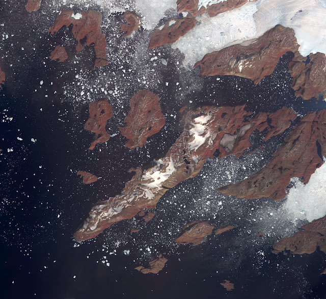
The west coast of Greenland is one of Earth's premiere incubators for icebergs, large blocks of land ice that break off from glaciers or ice shelves and float in the ocean, where they are transported by winds and currents and can pose potential threats to shipping. The Advanced Spaceborne Thermal Emission and Reflection Radiometer (ASTER) instrument on NASA's Terra spacecraft captured this image of icebergs off the west coast of Greenland, on July 17, 2005. The largest iceberg in the image, seen in the top center of the image coming off of a glacier, is about 4,128 feet (1,270 meters) in length. The image covers an area of 26.8 by 29.3 miles (43.2 by 47.2 kilometers), and is located at 74.6 degrees north latitude, 56.7 degrees west longitude. The reddish color on land is vegetation.
Photo credit: NASA/GSFC/METI/ERSDAC/JAROS, and U.S./Japan ASTER Science Team

No comments:
Post a Comment