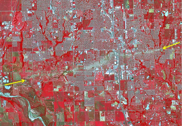
The Newcastle-Moore EF-5 tornado ripped through central Oklahoma on May 20, 2013, killing 24 people and leaving behind more than $2 billion in damage. On June 2, 2013, the Advanced Spaceborne Thermal Emission and Reflection Radiometer (ASTER) instrument on NASA's Terra spacecraft captured this image showing the scar left on the landscape by the tornado's deadly track. In this false-color image, vegetation is red, water is dark blue, roads and buildings are gray and white, and bare fields are tan. The tornado track crosses the image from left to right as indicated by the arrows. The image covers an area of 6 by 8.6 miles (9.6 by 13.8 kilometers), and is located at 35.3 degrees north latitude, 97.5 degrees west longitude.
Image credit: NASA/GSFC/METI/ERSDAC/JAROS, and U.S./Japan ASTER Science Team
Note: For more information, see NASA Spacecraft Sees Tornado's Destructive Swath.

No comments:
Post a Comment